Saturday, July 31, 2010

Bye, Lance

lance

Almost every sports outlet is reporting this morning that Lance Berkman is on his way to the Yankees – nothing official yet, but he seemed to be saying goodbye to team-mates at last night’s game.

Hard to believe, but the Chronicle confirms that he is the last active Astro to have played in the Astrodome. Tempus really does fugit.

Friday, July 30, 2010

Snakes

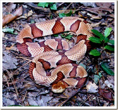
copperhead1 

Night before last, Honey went out the back door and saw a copperhead coiled just a foot or so from our back door.

Of course, by the time I got out there, the serpent was long gone.

Last night, we let the dogs out for their usual potty break before bed-time.  Dusty came running back into the house, and instead of going into her box, she headed into the living room.  I called her back and put her to bed.

This morning, her face and neck are swollen; her collar was so tight it’s a wonder she didn’t suffocate overnight.

Typically, Tinker and Dusty hunt snakes, but this is the second time in a row that one has been bitten by surprise.  (pooped pup)

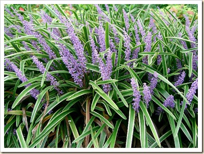
In a few minutes, I’ll be taking the weed-eater to the liriope.

Liriope_muscari1 It may not help, but it can’t hurt.


Thursday, July 29, 2010

Social Networking vs. Privacy

100729-facebook-download-hmed-220a.grid-6x2

A lot has been written in the media lately about personal security and social network sites like Facebook.

This morning a fellow named Ron Bowes posted a downloadable file which he claims has all public information on over 100 million Facebook subscribers.

The searchable file includes all information from the site (including pictures) which was not blocked by privacy settings, and even some that was – if, for example, you interacted with someone whose privacy settings were not as  strict as yours, your info may be available through theirs.  Changing settings or opting out won’t help now – your info is out there on a searchable file, available to anyone with enough available memory to download it.

The file is currently available at skullsecurity.org if you can access the site.  Since the story broke, their server has been overloaded.

Wednesday, July 28, 2010

Big Trees

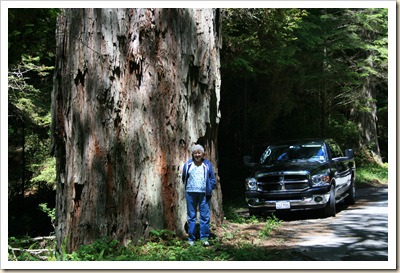
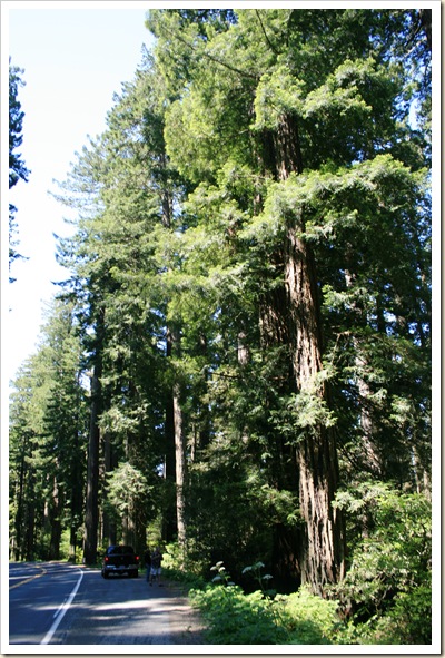
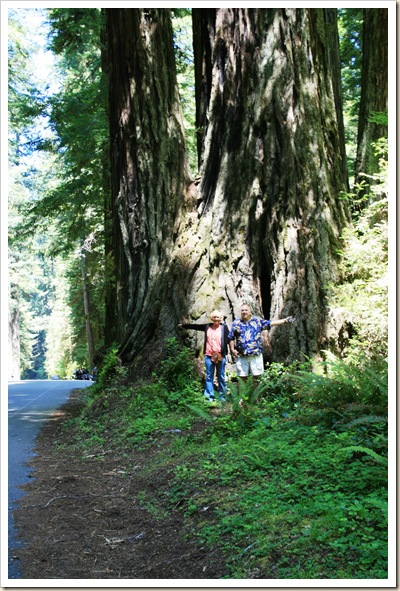
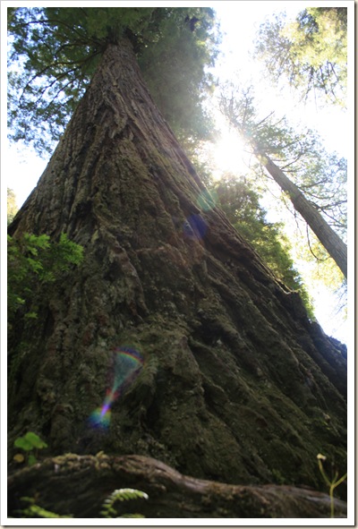
I was reminded that I didn’t post any pictures of the California Redwoods from our recent trip.  As I have noted previously, I was having connectivity issues at some RV parks around that time. Also, I wasn’t sure the shots would do them justice; even with cars or people in the photos, its hard to get a sense of how magnificent these trees really are.

Anyway, here are a few shots:

Honey and Truck

Along Drury Pkwy 2 - Prairie Creek Redwoods SPThissss BigSign at THE BIG TREE 2  

Looking Up 3Corkscrew Redwood 

Redwood National Park and several California State Parks share jurisdiction over the northern California Coastal Redwoods.  Most of these pictures are from the Prairie Creek State Park area. 

Tuesday, July 27, 2010

Boggy, Boggy Thicket

We dodged bad weather throughout or recent trip. 

For just over a month, it seemed like everywhere we went had experienced bad weather the day before we arrived or it came the day after we left.  Meanwhile, seems like it rained at home almost every day we were gone – Houston is on track to record its wettest July in history.

In Onawa, Iowa, we watched a huge thunderstorm pass to our north.  No rain, but gusty winds broke some huge limbs from the cottonwoods in the RV park.  Apparently, weather didn’t get much better after we left, since a dam failed up there this past weekend. CNN

The Missouri River was up in South Dakota, because of torrential rains that hit just before we arrived, but we made it all the way across the state, and spent a week at Custer under sunny skies.

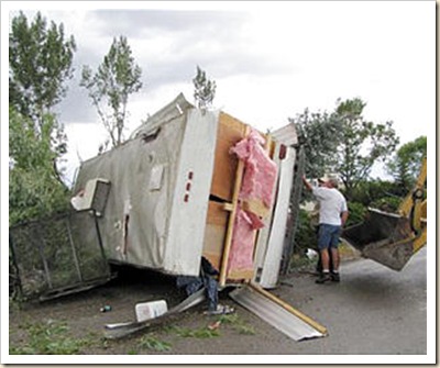
Weather was fine in Wyoming, Montana and Idaho while we were there.  Not so great last night; a rare tornado touched down, killing a couple farmers in Montana.  Another twister destroyed a motorhome in southern Utah on Monday.
3469532

The Oregon Coast was foggy for at least part of every day, but we’re told that’s normal.

We finally got rained on in Silver City, New Mexico.  Set up in the campground in the rain – something I normally don’t like to do, but in this case it was a welcome respite from the heat.  The city has had several flash flood watched and warnings since we left, but that’s normal.

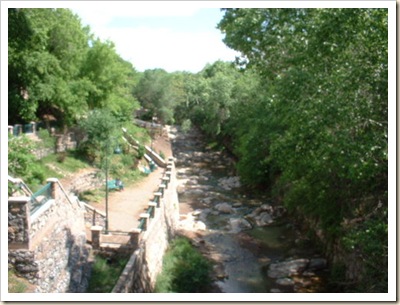
The town had originally been designed with the streets running north to south. The town was also built in the path of normal water runoff. Businesses sprang up and people learned to deal with the inconveniences of the summer rain. Silver City was built with high sidewalks in the downtown area to accommodate high flood waters. Meanwhile, uncontrolled grazing thinned down plant life on hills surrounding the town. During the night of July 21, 1895, a heavy wall of water rushed through the downtown business district, leaving a trail of destruction. A ditch 55-feet lower than the original street level was created in what was once known as Main Street.  
2268933

Businesses on Main Street began using their back doors on Bullard Street as main entrances and eventually, were permanently used as the new front entrances. To this day, the incorrect odd/even addressing conventions on the east side of Bullard Street are a reminder that the buildings were addressed on Main Street originally, not Bullard Street. Main Street now ends near the back of the Silver City Police Station, where the Big Ditch Park begins.

Our ditches were full when we arrived home, but I somehow got the 5th wheel backed into the driveway without running the truck into the mud across the street.  (Yes, I have done that before!) 

It took two days, but I was able to get the yard mowed before the rains set in again.  I was delayed by a strong thunderstorm night-before-last that dropped a 30 foot tree top at our front door.  The base of the trunk was about 10 inches in diameter, and although it miraculously missed hitting the house, it only missed the roof by 2 or 3 inches.

Rained all night last night and the back yard has an inch or two of standing water.  Think I’ll take today off.


Thursday, July 22, 2010

Two out of Three

11:30 last night, we had just gotten to sleep when SCREEEEEEEEEEEEEEEEEECH!!!!!!!!!!!

The LP gas detector in our 5th wheel went off. 
After an instant of confusion, followed by several seconds of pure panic, I located the darn thing and took it off of its mounting to remove the batteries. 

Surprise! The damn thing is hard-wired into the system – no batteries to remove.  Meanwhile, it is still screeching at a dB level that could probably be heard in Dallas.

I knew we didn’t have a propane leak, so I cut a wire to shut it up.  Then I read a tiny label on the alarm that said, “Replace - July 2010.”

Back to bed, then at 1:30 a.m. we heard

BEEP!  BEEP! BEEP! BEEP!

The low battery alarm on the carbon monoxide detector went off.
Ripped that of the wall and removed the batteries. 

There is only one other alarm in the trailer, the smoke alarm. Took it off the ceiling and was going to disable it too, but Honey wouldn’t let me. 

Went outside and had a cigarette and a beer – finally got back to bed about 2:30 or so.  No more incidents and we finally got to sleep.

For what it’s worth, the smoke alarm works fine – set it off cooking sausage for breakfast this morning.

Wednesday, July 21, 2010

Guadalupe

On the banks of the Guadalupe River in Kerrville, Texas.

The river is beautiful – much better than last year when it was almost dry this time of year.

Had a real disappointment two days ago when we arrived at Balmorhea State Park.  I hadn’t been there since I was twelve years old, and I was really looking forward to taking a dip in the huge spring-fed pool.

Balmorhea State Park features drive-through campsites with lights, water and cable TV.  Unfortunately, when I pulled up enough to connect my power cable, I didn’t have enough room in front to disconnect the truck from the trailer. 

After several tries, we finally gave up and left.  Spent the night in a small but nice campground adjoining a truck stop, then came to Kerrville a day early.

Just as well, we love this place.

Monday, July 19, 2010

No Thanks, Mr.. Hughes

The previous entry was supposed to be posted yesterday.  We were in an RV park with excellent Wi-Fi, but when I attempted to post to my blog, it sat and sat, and finally timed out.

Turns out the park’s ISP was Hughes Net.  Fast downloads, but uploads almost slower than dial-up.

Today we’re at another campground, and the post uploaded fine. 

Back to Texas tomorrow – a long haul from Silver City, New Mexico to Balmorhea Texas.

Grand Canyon – Meteor Crater

No entry yesterday after our visit to the North Rim of Grand Canyon because:

  1. Wi-Fi at the campground was terrible – Kept losing connection.
  2. I was tired – decided I could give myself the evening off.

View fom Bright Angel Point 2- Grand Canyon NP

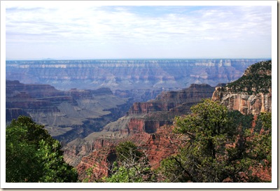
Folks who had been to both kept telling us that if we had only been to the South Rim, we had to visit the North Rim.  Now that I have, I can tell you that they were right.
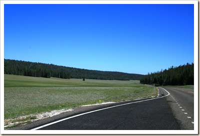
The drive down through Kaibab National Forest is pretty,

Meadow on Hwy 67 - Kaibab Natl Forest

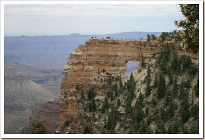
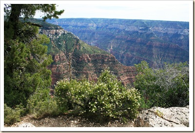
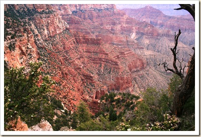
but the Canyon itself is fantastic.

Angel's Window 3

Cliff Rose and Canyon - Grand Canyon NP

View from Cape Royal 2- Grand Canyon NP


Lots of visitors from all over, and a Lodge and Welcome Center larger than I had been led to expect.  Still, crowds and traffic were much better (lighter) than on the South Rim.

Drove today to Meteor Crater near Winslow, Arizona. 

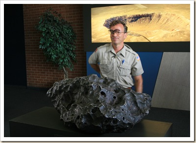
The movie, the museum and the guide’s lecture were fascinating, but the crater was not that impressive after a day at Grand Canyon. 

Meteor


Tomorrow will see us in Silver City, New Mexico.

Friday, July 16, 2010

Kanab Utah

Said good-bye to the Sheltons and Nevada this morning and drove to Kanab, Utah. 

Travis and Cheryl headed for Colorado where they plan to meet up with their daughter. Later, on their way home, they hope to pick up their newly repaired motorhome in Oklahoma.

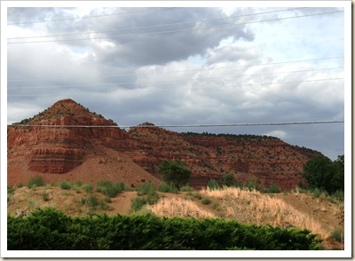
On the way down, we passed near the entrances to Bryce and Zion National Parks, and saw the Pink Coral Sand Dunes State Park.  Whatever else you might say about Utah, it is colorful.

Hwy 89 Near Bryce Canyon NP

Hwy 89 Near Bryce Canyon NP 2

We’re staying at the Kanab RV Corral

Kanab RV Corral

and headed for the North Rim of Grand Canyon tomorrow.  Here are a couple shots from our campground.

View from Campground 2- Kanab UT

View from Campsite - Kanab UT

We went grocery shopping this afternoon at Honey’s Market.  I told Honey to show them her driver’s license so we could get an owner’s discount.  The got a good laugh about that, but they did stamp our register receipt, which gave us a 15 cent per gallon discount on diesel – saved us $3.50.

Thursday, July 15, 2010

Least Visited National Park

Currently in Baker, Nevada – still in the Pacific Time Zone by about 100 yards. Mountain Time starts at the Utah line just past the campground office.

Baker is on US 50, which Life Magazine labeled the “Loneliest Highway in the USA.” Apparently, Nevada is proud of that – “Loneliest Highway” signs appear more often than mileage markers.

Today we visited Great Basin National Park; the least visited national park in the system. Not surprising, considering the location.

The park’s attractions include Wheeler Peak

Wheeler Peak - Great Basin NP 3

which at 13,000 feet, sports a glacier within sight of miles of desert,

Valley from Mather Overlook

and Lehman Caves, which is actually a single cavern in spite of the name. Rangers give tours which range from an easy one-hour visit to serious spelunking with special reservations.

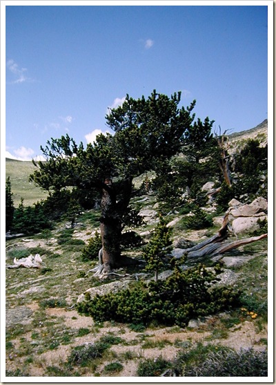
The other attraction is a couple of groves of Bristlecone Pines.

RMbristlecone

These gnarly little trees are the oldest living things in North America, with some in the park exceeding 3000 years of age. Makes the California Redwoods look like adolescents.

Tuesday, July 13, 2010

More Great Lakes

Currently in Carson City, Nevada.  I can see a casino from our campsite, but just can’t generate enough energy to cross the road. 

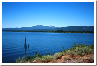
Saw two beautiful lakes today.  The first was Lake Almanor on Hwy 36 between Redding, California and the Nevada border.

Lake Almanor from Hwy 36 2

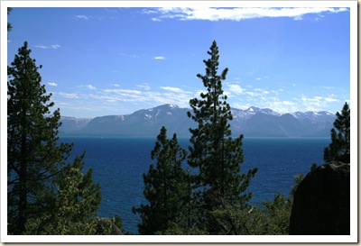
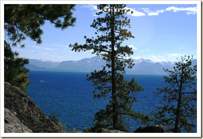
Then. once we got to Carson City, we made a side trip up to Lake Tahoe.

Lake  Tahoe from Logan Shoals Vista 3

Lake  Tahoe

Lake  Tahoe 3

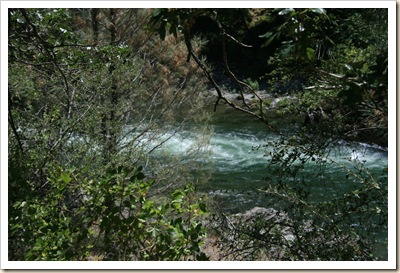
If you like your water smaller but faster, Hwy 299 west of Redding parallels the Trinity River for miles.  Unfortunately, the best views are in places where there is nowhere to pull off the road.

Trinity River - Hwy 299

Monday, July 12, 2010

Old Friends

Currently in Redding, California, in an RV park on the banks of the Sacramento River.  The trip down from Brookings, Oregon via 101 and 299 was 61/2 hours of non-stop twists and turns and 6 to 8% grades. 

At least after we left the coast, the fog lifted and we could see the road.  We went from mid-60s in Oregon to upper 90s here.

Yesterday, while still in Brookings we had a surprise visit from Ron and Cheryl Moore.  Ron is an old friend and former co-worker, and I had met Cheryl years ago at Disney World at a Canon Trainer’s Conference.  They retired last spring, sold their home and are now full-timing in their motor home. 

Ron saw that we were in Brookings on the blog – they were in another campground about 4 miles away – so they came by.  We enjoyed a pleasant couple of hours catching up.  Great coincidence.  Great to see them again.

Sunday, July 11, 2010

Campground Visitors

Doe with Fawn Above Campground

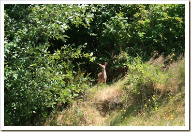
Saw this Mule Deer Doe and Fawn on the path above our campsite yesterday afternoon.  After I took this picture, I saw a second Fawn bringing up the rear.  He was about 30 yards behind the others.

Fawn Above Campground 2

Today is our last day in Brookings, Oregon.  Gonna miss this place.

Saturday, July 10, 2010

Dogsh#t Daisies

Daisies with Ladybug - Banks of Chetco River

There are lots of flowers, both cultivated and wild,  along the southern Oregon coast.  Just south of Brookings is the Elk Valley, which bills itself as the Easter Lily Bulb Capital of the World.  There are acres of lilies about four inches tall and currently in bloom.  Laborers are in the fields harvesting the bulbs.

Along the banks of the Chetco River, where we are staying, are a variety of flowers in bloom, including the daisies shown above.  We harvested a few, and Honey made a bouquet for the trailer.

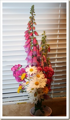
Wildflower Bouquet from Banks of Chetco RiverIncluded were Daisies, Marigolds, Sweetpeas and Bird Vetch – the tall spikes with the trumpet-shaped purple flowers; all collected along about 150 feet of riverbank.

It looked really nice and brightened the living room, but about an hour after it was finished we started smelling puppy poop.  We scowled at the dogs, checked under table and chairs and behind the couch.  Honey inspected the bottoms of all our shoes with no result, but we were still getting an occasional whiff that was unmistakably doggie doo.

We endured it for several hours; then, just before bedtime, Honey smelled the bouquet.  Wild Oregon Daisies smell just like dog crap!  We had noticed the smell in spots along the path – blamed irresponsible pet owners –but we never made the association.

Who would have thought those pretty flowers would smell like that?

Thursday, July 8, 2010

Brookings, Oregon

Arrived in Brookings, Oregon yesterday.  The 200 mile drive from Klamath Falls felt more like 400 – Lots of sharp curves 6 and 7% grades, but definitely worth the trip.  It’s a beautiful drive that actually dips down into northern California and the Redwoods National Park before swinging back up to Brookings on US 101.  Saw our first redwoods on the way down – amazingly huge, and these are not even the biggest ones.  No pictures yet, but we are touring the coastal redwoods tomorrow or the day after, so there will be some soon.

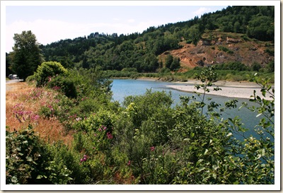
Our campsite is on the banks of the Chetco River

Chetco River from our Campground - Brookings OR

Chetco River from our Campground 3 - Brookings OR

Chetco River from our Campground 4 - Brookings OR

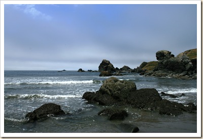
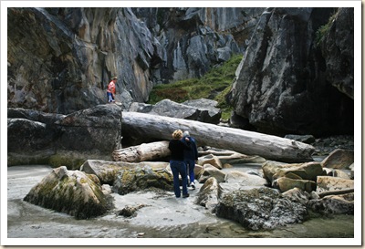
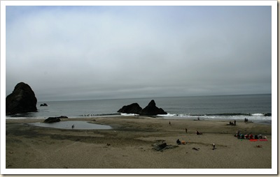
Went down to the beach today at Harris State Park and Lone Ranch State Park, two sites just a couple miles north of town. First at Harris SP :

Harris State Park 4- Brookings OR

Lone Ranch SP 2 - Brookings OR

Then, after the fog lifted and the clouds burned off, at Lone Ranch SP.  We met an old man who told us that Lone Ranch used to be a sheep ranch, and he worked there herding sheep for fifty years before it was donated to the state a few years ago.  He wanders around the park looking for artifacts – says he often finds arrowheads and pieces of farming implements.

Lone Ranch SP 4 - Brookings OR

Lone Ranch SP 10 - Brookings OR

Driftwood - Lone Ranch SP 

Lone Ranch SP - Brookings OR

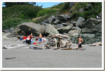
Driftwood Fort - Lone Ranch SP

The beach is beautiful, but cool.  Adults in sweatshirts or jackets, kids in the water in bathing suits. 

Tuesday, July 6, 2010

Oregon Variety

No posts for a while – on the road with limited access.

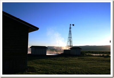
In the past few days we have gone from enjoying the waters of the Crystal Crane Hot Springs in the western Oregon desert at Burns, Oregon IMG_3156

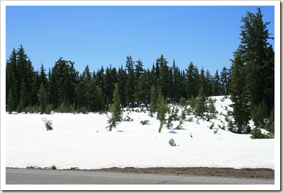
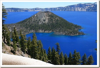
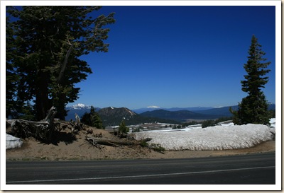
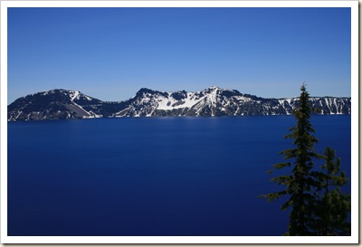
to the snow Crater Lake National Park.

IMG_3167

IMG_3179

IMG_3190

IMG_3191

Next stop – the Pacific Coast.